
|
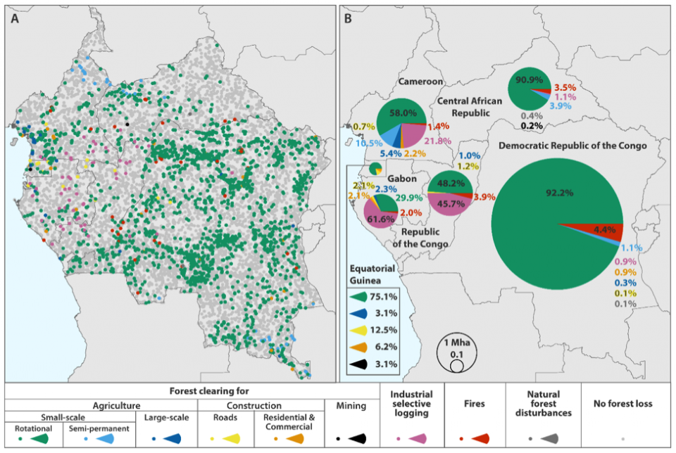
Small holder clearing drives forest loss in the Congo BasinA regional assessment of forest disturbance dynamics from 2000 to 2014 was performed for the Congo Basin countries using time-series satellite data. Area of forest loss was estimated and disaggregated by predisturbance forest type and direct... Read more |
|
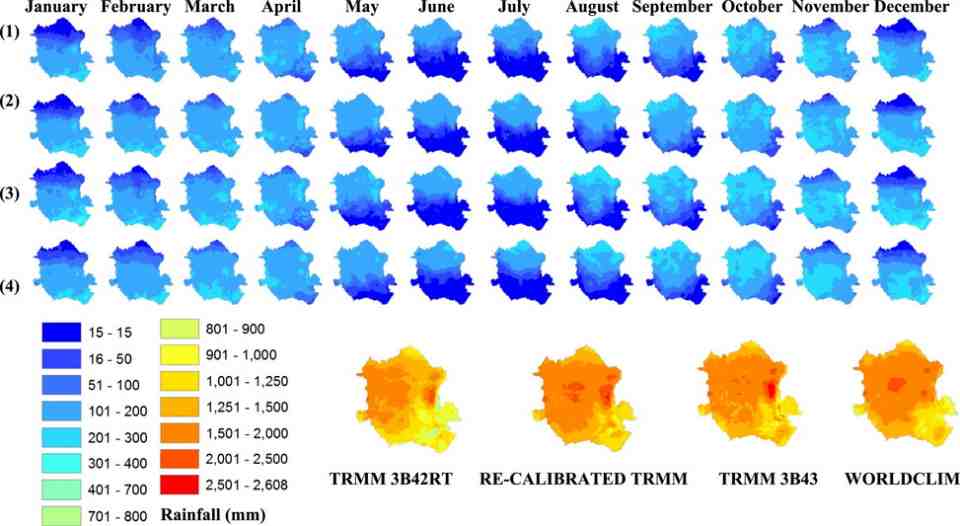
Characterizing Congo Basin Rainfall and Climate Using Tropical Rainfall Measuring Mission (TRMM) Satellite Data and Limited Rain Gauge Ground Observations (2015 JAMC-D-14-0052.1)Quantitative understanding of Congo River basin hydrological behavior is poor because of the basin’s limited hydrometeorological observation network. In cases such as the Congo basin where ground data are scarce, satellite-based estimates of... Read more |
|
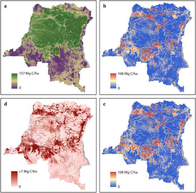
National-scale estimation of gross forest aboveground carbon loss: a case study of the Democratic Republic of the Congo (2013 Environ. Res. Lett. Volume 8, Number 4)Recent advances in remote sensing enable the mapping and monitoring of carbon stocks without relying on extensive in situmeasurements. The Democratic Republic of the Congo (DRC) is among the countries where national forest inventories (NFI)... Read more |
|
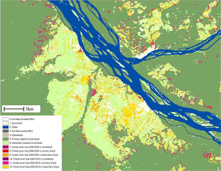
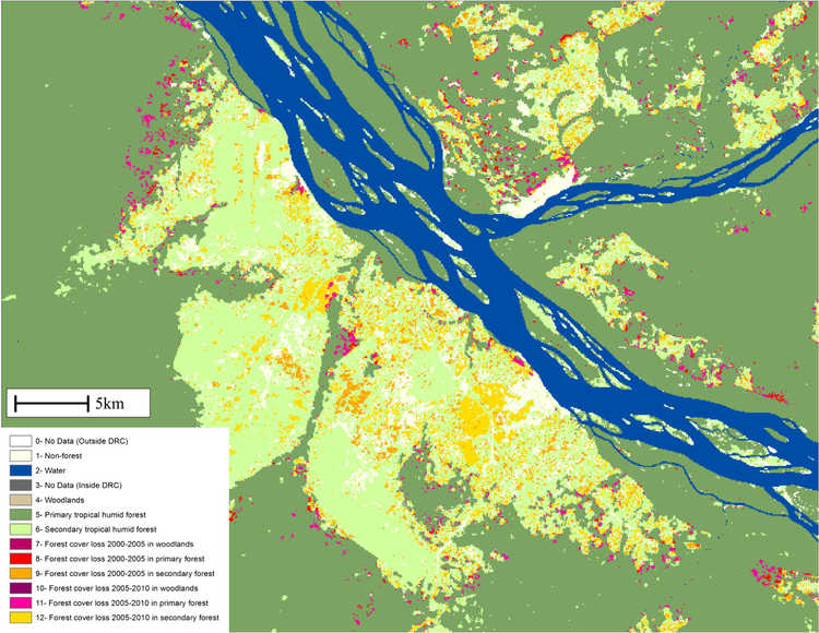
Forest cover dynamics of shifting cultivation in the Democratic Republic of the Congo 2000–2010 (2015 Environ. Res. Lett. 10 094009)Shifting cultivation has traditionally been practiced in the Democratic Republic of Congo (DRC) by carving agricultural fields out of primary and secondary forest, resulting in the rural complex: a characteristic land cover mosaic of roads,... Read more |
CARPE is an initiative of the United States Government. The website is hosted at University of Maryland.
 : +243 81 555 4430
The information provided on this web site is not official U.S. Government information and does not represent the views or positions of the U.S. Agency for International Development or the U.S. Government
 :
:  :
: 